|
Virtual Cities Links
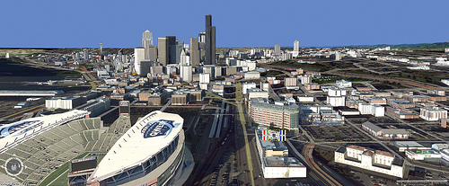
courtesy of the Virtual Terrain Project
Uses and Hype
Tourism, Planning
Small Terrain Areas / DTM
Long-term Goals of the VTP
Community,
Media
Data Openness
Elevation
Data Sources:
DEM, DTED
Global Datasets:
SRTM
Bathymetry,
Artificial Terrain
Caves,
Contour Data
BT Repository
Ground Detail
Imagery:
Formats,
Satellite,
Aerial,
Whole-Earth,
Free Sources,
Commercial Sources,
Processing Multi-band Images
Geotypical, Ground Cover
Large Textures in Hardware
How to Apply Textures
Spherical Textures
Detail / Blending
Rendering
Level of Detail (LOD):
Papers,
Implementations
Spherical Grids,
Paging
TINs: precomputed,
runtime
Light & Shadows,
Dynamic Range
Sky / Atmosphere,
Clouds
Water, Fog,
Rain, and Lighting
Performance,
Navigation
Draping
Data Sources and Formats
Coordinate Systems /
UTM
Point Data
Vector Data (DLG, TIGER, VMAP..)
Polygon Data (LULC..)
Topographical Maps (DRG..)
Water Data
SDTS
Network Protocols:
WMS, WFS
Data Collection (GPS, Surveying)
Integrating Multiple Data Sources
Representing Unknown Values
Global Data Sharing/Referencing
Cell Registration
Distance |
Culture
Roads /
Rail and Fences /
Power
Buildings and Cities:
Procedural Buildings
/ Roofs
Research and Projects
Commercial Services
Commercial Building
Data
Culture Classification
Vehicles and Traffic
Geocoding
Flight-Sims
Plants
Overview
Books and Papers
Software Tools /
Xfrog
Distribution on Terrain
Geometric Modelling
Creating Plant Texture Maps
Plant Images and Databases
Forestry
The VTP Software
Implementation and Development
Vegetation,
Plant Library
Libraries:
vtlib, vtdata
File Formats: BT,
VTST,
VF,
Loc/VTAP
Screenshots
Applications:
Enviro,
VTBuilder,
BExtractor
Internationalization
Other Terrain Software
Commercial
Noncommercial
Government / Academic
Artificial / Artistic
Location-specific
GIS, CAD,
3D Modeling
Games, Defense,
Simulation
Virtual Tourism
Software Utilizing the VTP
Earth Viewers chart
Modelled Areas
Overview
United States:
California,
Hawai'i,
Nevada,
New York,
Washington
International:
Africa,
Asia,
Australia,
Costa Rica,
China,
Canada,
Europe,
France,
Germany,
Greece,
Italy,
Japan,
Middle East,
New Zealand,
North America, Central America,
Romania,
South Africa,
South America,
Spain,
Switzerland,
UK
Beyond Earth
|
