

Class on April 29 2019
Bruce introduced the students to the Collaborative Ocean Visualization Environment (COVE) he and other members of the
Center for Environmental Visualization oversaw creation of during 2004-2007.
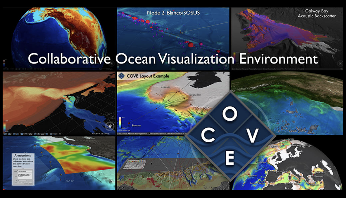
COVE was developed to help an artistically trained professional create useful maps, videos, and other content from geospatial and geotemporal data.
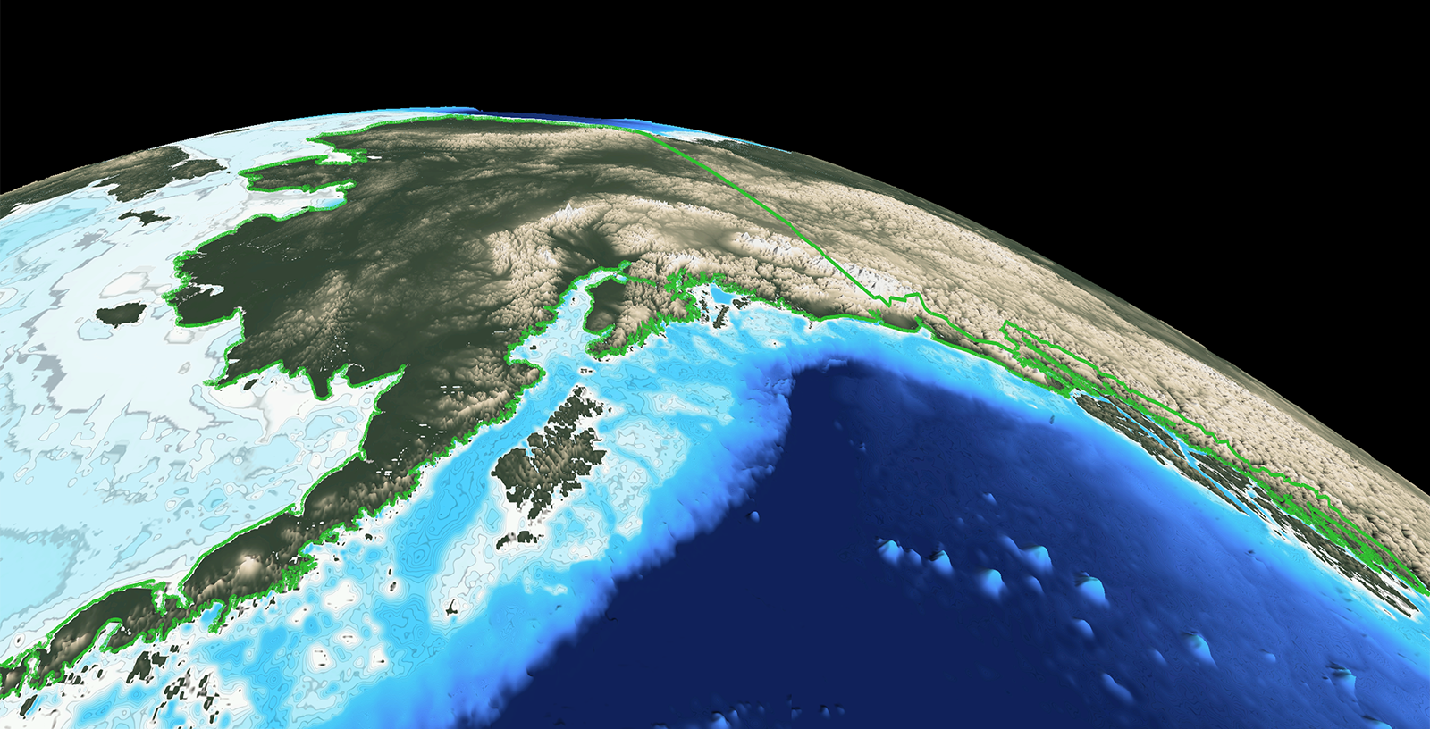
COVE describes visualizations via a COVE Markup Language (COVEML). An example is the map of alaska CML file which controls the visualization seen here:
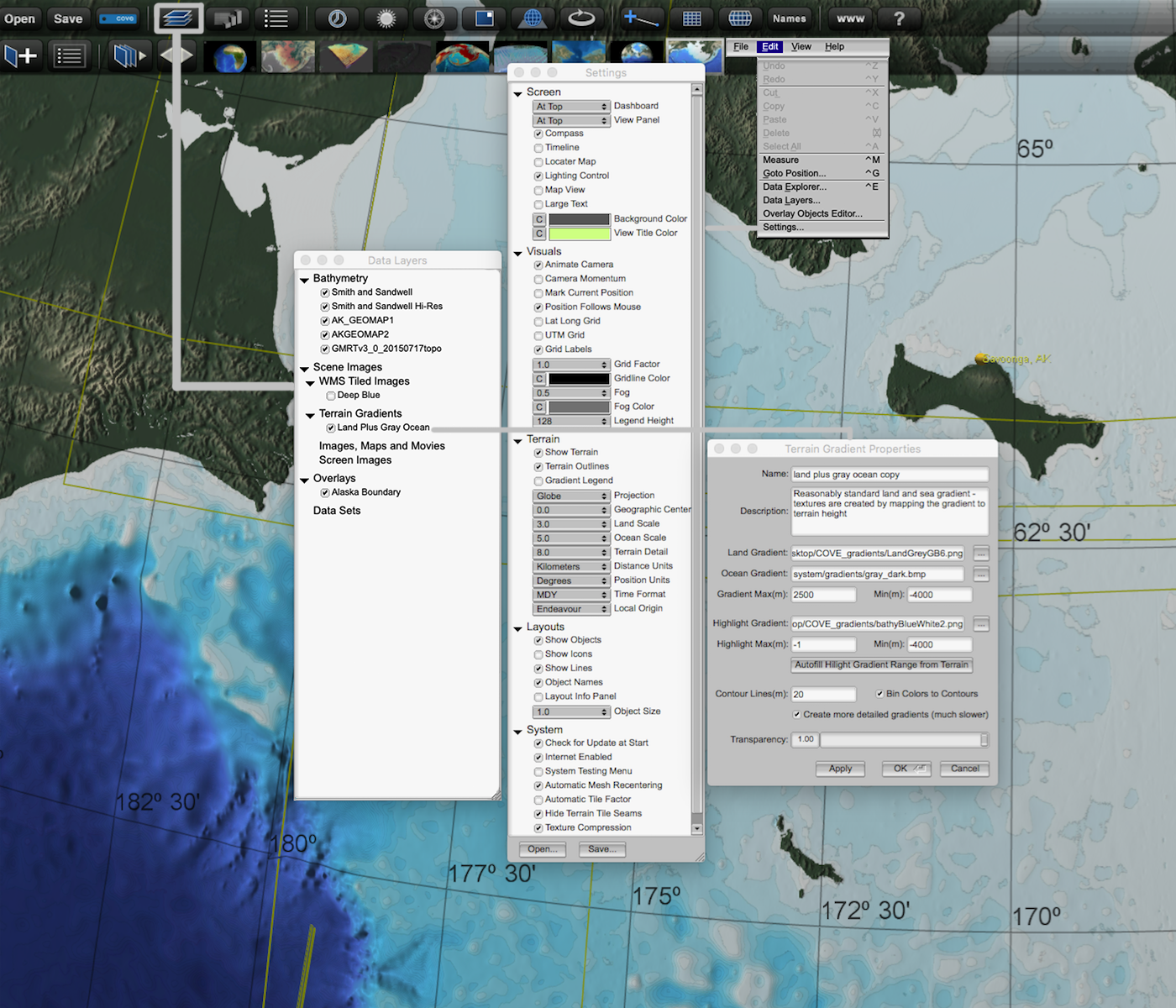
Bruce demonstrated how to use the interactive tools to make changes to the visualization, as well as how to navigate a visualization that is active in the COVE software. Students followed along to load contents of a geospatial archive into COVE and play with the settings used in making the map above:
Students then played with two other archives to create maps of interest based on their artistic training (including the review of concepts from earlier weeks in this course):
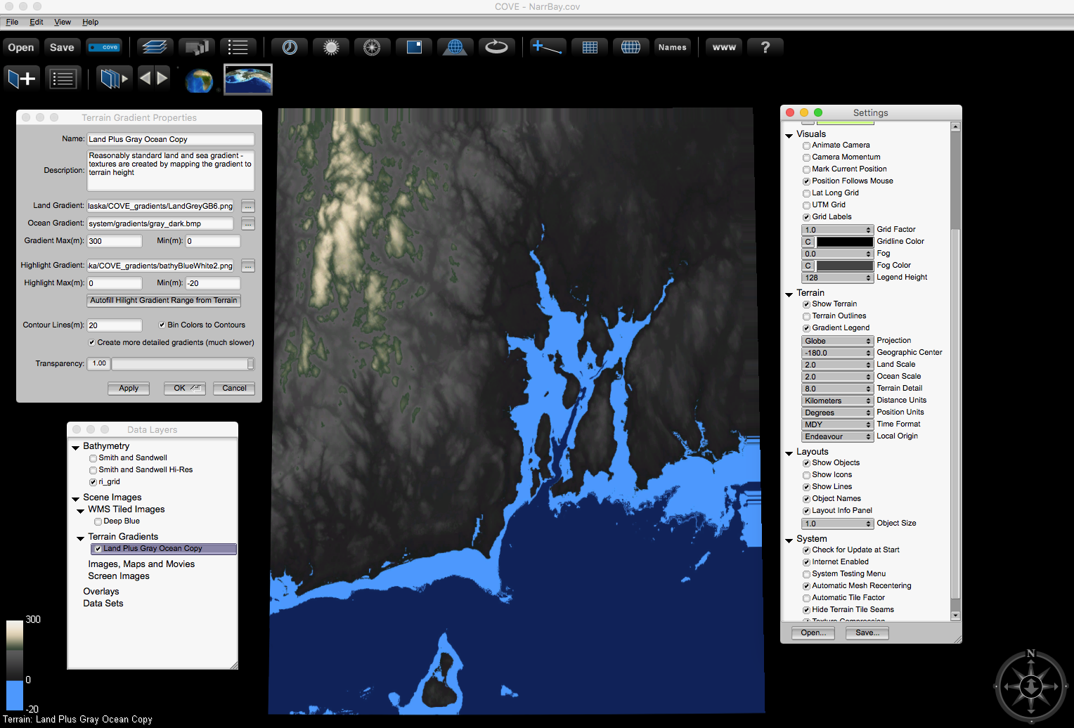
Students used the Narragansett Bay ASCII grid file with in a COVE NarrBay.cml markup file to create a map like:
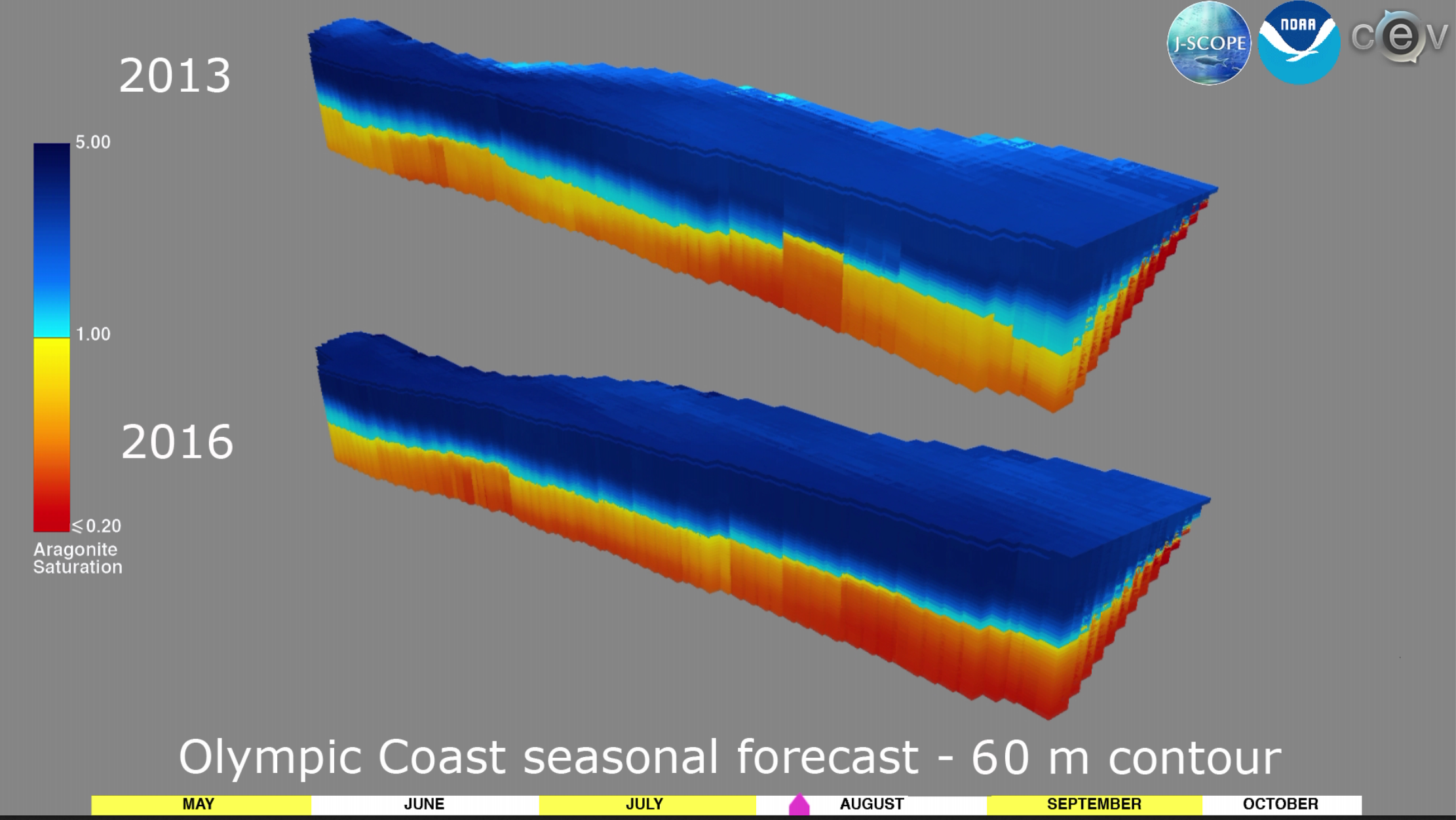
And students played with a CML file that was used to create videos of currents properties off the Oregon coast from which this screen shot was taken:
COVE was developed to help an artistically trained professional create useful maps, videos, and other content from geospatial and geotemporal data.
COVE describes visualizations via a COVE Markup Language (COVEML). An example is the map of alaska CML file which controls the visualization seen here:
Bruce demonstrated how to use the interactive tools to make changes to the visualization, as well as how to navigate a visualization that is active in the COVE software. Students followed along to load contents of a geospatial archive into COVE and play with the settings used in making the map above:
Students then played with two other archives to create maps of interest based on their artistic training (including the review of concepts from earlier weeks in this course):
Students used the Narragansett Bay ASCII grid file with in a COVE NarrBay.cml markup file to create a map like:
And students played with a CML file that was used to create videos of currents properties off the Oregon coast from which this screen shot was taken: